The Nabanga Pikinini Map of Vanuatu
In 2013 it was decided to include a map with the books - initially the plan was to have a dust jacket on the books which would open into a map. After much consideration this was decided against and an A1 sized poster/map was printed.
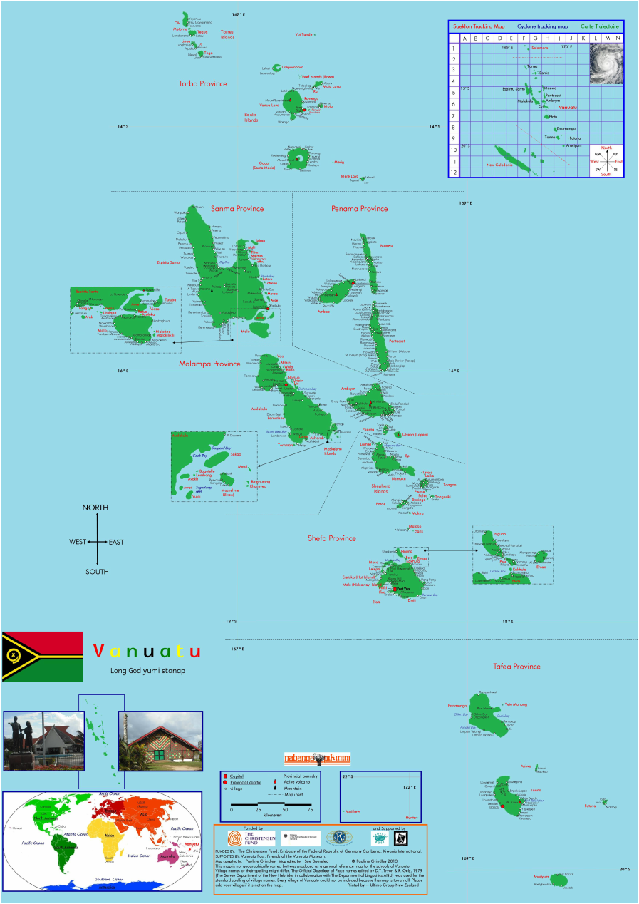
Pauline Grindley compiled the map. Pauline is not a cartographer - this map is not geographically correct. The function of the map was to include as many villages as possible. The cyclone tracking map was included to help children understand how to use this information as the tracking map is used when cyclone information is broadcast via the radio or mobile phone messages.
Sue Baereleo with her vast knowledge of Vanuatu and its schools was able to identify villages that had schools.
Copies of the map were sent to all the primary and pre-primary schools in Vanuatu.